Module 4: Geoprocessing
The purpose of this week's lab was to design a model in ModelBuilder in ArcGIS Pro and use Python 3 to create a script to perform multiple geoprocessing tasks.
For the first part of the assignment, I used ArcGIS Pro created a model in ModelBuilder called SoilErase. The model clipped all soils to the extent of the basin, selected all soils classified as "Not prime farmland" and erased the "Not prime farmland" from the basin polygon. Three geoprocessing tools were added to the model: Clip, Select and Erase. When successfully run, the model produced the following shapefile:

For the second part of the assignment, I used Spyder IDE to create a script to perform 3 geoprocessing tasks on a hospitals shapefile. Before writing the script, I found it useful to visualize the tools with their inputs and outputs by first creating the model in ModelBuilder. For the script, I included code to import the arcpy modules and set the workspace to the Data folder. The 3 geoprocessing tools I used were: Add XY Coordinates, Buffer and Dissolve. The final output has XY coordinates with 1000 meter buffer dissolved as a single feature layer. I included code to overwrite outputs and save the outputs in my Results folder. After each of the 3 tools, I included code to print the messages from that tool using the GetMessages() function. When run, the script successfully returns the following messages:

For the first part of the assignment, I used ArcGIS Pro created a model in ModelBuilder called SoilErase. The model clipped all soils to the extent of the basin, selected all soils classified as "Not prime farmland" and erased the "Not prime farmland" from the basin polygon. Three geoprocessing tools were added to the model: Clip, Select and Erase. When successfully run, the model produced the following shapefile:

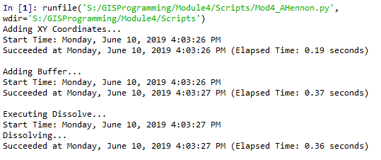
For the second part of the assignment, I used Spyder IDE to create a script to perform 3 geoprocessing tasks on a hospitals shapefile. Before writing the script, I found it useful to visualize the tools with their inputs and outputs by first creating the model in ModelBuilder. For the script, I included code to import the arcpy modules and set the workspace to the Data folder. The 3 geoprocessing tools I used were: Add XY Coordinates, Buffer and Dissolve. The final output has XY coordinates with 1000 meter buffer dissolved as a single feature layer. I included code to overwrite outputs and save the outputs in my Results folder. After each of the 3 tools, I included code to print the messages from that tool using the GetMessages() function. When run, the script successfully returns the following messages:


Comments
Post a Comment